The City of Charleston is running dozens of flood, drainage, and mobility projects at once. Here they are, sorted by neighborhood, so you can check what is happening near a specific home before you write an offer.
My companion piece, What Charleston is building next, tells the story of the headline projects: the new parks, the Lowline, Union Pier, the rec centers. This one is the working map. It is less of an essay and more of a lookup, because the question my buyers actually ask is narrower and more useful: not what is the city building, but what is the city building near this house.
That matters more here than almost anywhere I have worked. In a coastal city, public drainage spending is not a nice-to-have. It shows up in your flood insurance, your resale, and how you feel every September when the tide and the rain arrive at the same time. So I pulled the city’s current project list apart and put it back together the way a buyer needs to read it, by area.
How to use this. Find your target area below. Each project carries a short note on why it matters to a buyer, in one of two ways: flood and drainage work affects your insurance, your resale, and your peace of mind, while mobility work affects access, commute, and the value that follows both. A project near a home is a genuine signal, not a guarantee. Read to the bottom for how to verify any of it against a specific address.
The Peninsula: downtown and the upper neck
The peninsula carries the oldest, lowest, and most valuable ground in the region, so it also carries the heaviest drainage engineering. If you are buying south of the Crosstown or up through Wagener Terrace and the Eastside, this is your list.
Flood and drainage
- Spring / Fishburne Drainage Improvements. The big deep-tunnel and pump system draining the low ground around the medical district and the Cannonborough and Elliotborough neighborhoods toward the Ashley. One of the largest drainage efforts on the peninsula. If you are buying anywhere in that basin, this is the project that is meant to take water off your street.
- Medical District Tunnel Extension. Extends that same tunnel system deeper through the hospital district. It protects a corridor that floods badly and the blocks that feed into it.
- Low Battery Seawall Repair. Rebuilding and raising the historic Low Battery wall along the southern tip. This is tidal and surge protection for South of Broad, some of the most exposed and most expensive real estate downtown, and it is also a beloved public walk.
- Market Street Drainage Improvement. Drainage upgrades along Market Street in the heart of the historic core, a chronic flood corridor.
- Huger Street and King Street Drainage Improvements. Upper-peninsula drainage at a junction that is notorious for standing water.
- Cooper-Jackson Stormwater Improvements. Stormwater work on the upper peninsula near the Eastside.
- Wagener Terrace Outfall Cleaning and North Nassau Pipe Replacement. Smaller, targeted maintenance in the Wagener Terrace and Eastside neighborhoods. Unglamorous, but exactly the kind of upkeep that keeps a specific block draining.
Getting around
- Meeting Street Road Diet. The city and SCDOT are restriping Meeting Street Road from Mount Pleasant Street up to the Port Access Road, a truck-heavy stretch on the neck. Safety and flow on a corridor that has needed both.
- Comprehensive Parking Study. A peninsula-focused study shaping the city’s future parking and curb decisions. Anyone buying downtown, where parking is part of the value, should know it is in motion.
- Two-way traffic feasibility study. Led by the firm Kimley-Horn, this study looks at converting Coming Street, Rutledge Avenue, and Ashley Avenue back to two-way traffic. If you are buying in Cannonborough, Elliotborough, Hampton Park Terrace, or the medical-district edges, the outcome could change your street’s traffic and livability.
For the peninsula’s bigger-picture moves, the Battery Extension surge-protection project, the Lowline linear park, and the Union Pier waterfront, see the companion post.
West Ashley: the Church Creek basin and beyond
West Ashley is where a lot of my first-time and move-up buyers land, because the price per square foot still makes sense inside the city. It is also home to the region’s most notorious repetitive-flooding area, the Church Creek basin, which is exactly why so much of the city’s drainage money is pointed here.
Flood and drainage
- Church Creek Flood Storage. Creating flood-storage capacity in the Church Creek drainage basin. If you are shopping the neighborhoods inside that basin, this is the single most important project on the page for you, and the flood history there is something I walk every buyer through before they fall for a house.
- Dupont-Wappoo Watershed Master Plan. A long-range master plan for the Dupont Road and Wappoo drainage watershed. It sets the drainage roadmap for a wide swath of West Ashley, so it tells you where the city expects to spend next.
- Lake Dotterer Flood Reduction Project. Flood reduction around Lake Dotterer, within the same troubled basin.
- Windermere Drainage Improvements. Drainage upgrades in the older, close-in Windermere neighborhood off Savannah Highway.
- Barberry Woods Drainage Improvements and Oak Forest Outfall System Improvements. Neighborhood-scale drainage work off the Bees Ferry and Savannah Highway corridors.
- Savannah Highway Roadside Drainage Improvements. Roadside drainage along the US 17 South corridor that carries much of West Ashley.
Facilities and getting around
- New West Ashley City Office, 1660 and 1662 Ingram Road. A new municipal office building, with construction slated for early 2026, meant to bring city services closer to West Ashley residents. It is also a straightforward signal that the city is still investing in this side of the river.
- W.L. Stephens Aquatic Center rebuild, Forest Park. A replacement for the aging aquatic center, funded as part of a roughly three-million-dollar council allocation covering design, engineering, and oversight for two new rec centers. A year-round amenity like this is the kind of thing that makes a neighborhood sticky. The fuller rebuild is covered in the companion post.
- West Wildcat Boulevard Roundabout. A roundabout being designed at West Wildcat Boulevard and William E. Murray Boulevard, easing a growing West Ashley intersection.
- Ashley River Crossing. A dedicated bike and pedestrian bridge that will finally link West Ashley, by way of the Greenway and Brittlebank Park, to downtown without sharing a lane with traffic. A separated connection like this has historically lifted the value of the neighborhoods that feed it.
Johns Island
Johns Island is growing faster than almost anywhere in the region, and its drainage and amenities are racing to keep up with it.
- Johns Island Restoration Plan. A watershed and drainage restoration effort for an island that still runs largely on ditches and tides. As Johns Island fills in, how the water is managed becomes central to what a home there is worth.
- Johns Island Rec Center. A new aquatic and recreation center, with design and engineering funded as part of that same roughly three-million-dollar allocation. A first-of-its-kind daily-use amenity for the island.
- Nature-based flood parks. The city’s flood-storage parks, including the Dale T. Morris park on Johns Island, are covered in the companion post.
James Island
James Island trades on its short hop to both downtown and Folly Beach, which makes its two river crossings and its main artery, Folly Road, the whole ballgame.
- Rethink Folly Road. A complete-street study for the Folly Road corridor, the island’s spine, looking at mobility, land use, public space, and stormwater together. The city treats it as a model for other corridors, and it is the plan most likely to reshape everyday life on the island.
- Camp Road Drainage Study and Signal Point Road Drainage Improvements. Early-to-active drainage work along two James Island corridors. A study is not a fix, but it flags where the water problems, and the future spending, are.
- Central Park Drainage Improvement Project. Additional neighborhood drainage work on the island side.
- James Island Connector Bicycle Safety Analysis. A study of how to add a safe bike crossing over the Ashley, since the Connector currently bans bicycles. It is about future connectivity between James Island and the peninsula.
The rest of the region
One important caveat: nearly everything above is City of Charleston work. The towns just outside the city limits, Mount Pleasant, Summerville, Folly Beach, and the county’s unincorporated areas, run their own separate project lists and their own drainage rules. If you are looking at, say, Mount Pleasant or the fast-growing Summerville and Berkeley County corridor, the map is different, and it is one I am glad to pull for you. The regional headline for the East County, including the nearly 94-acre future park near Awendaw, lives in the companion post.
The citywide plans that decide who gets money next
Behind the individual projects sits a layer of strategy that tells you where the next round of spending is headed. You do not need to read these cover to cover, but you should know they exist, because they are how the city decides which basin gets funded.
- Basin Flood Action Program (BFAP). The city’s effort to organize flood work basin by basin and publish maps of what is planned or underway in each one. For a buyer, this is the single most useful public tool for checking a specific address.
- The Water Plan and the Sea Level Rise Strategy. The long-horizon frameworks for managing flood risk citywide.
- Dutch Dialogues and Living With Water. The design philosophy, developed with Dutch water experts and Historic Charleston Foundation, behind much of the nature-based work you see above.
- All Hazards Vulnerability and Risk Assessment. The study the city uses to rank which populations and assets are most at risk, which in turn shapes the capital budget. In plain terms, it is part of how a basin moves up the funding line.
Programs you can actually use once you own here
A few of these are not projects at all but standing programs, and they are genuinely handy for a new owner. Worth knowing before you close.
- Adopt-A-Drain. You can adopt a storm drain near your home and keep it clear of leaves and debris. A clear drain is a small, free hedge against the flash flooding that comes with a hard Lowcountry rain.
- Charleston Rainproof. Guidance and resources for capturing rainwater on your own lot, from rain gardens to smarter grading, so your property holds less water and sheds it better.
- Free composting drop-off. A regional partnership lets residents drop food scraps for free at sites across the area, which quietly cuts what you send to the landfill.
- Tree canopy planting. Most of the room left for new trees is on private land, so the city’s canopy program leans on owners. Shade and canopy are part of what keeps an older Charleston street both cooler and more valuable.
The smaller neighborhood drainage list
Beyond the big capital projects, the city keeps a rolling list of smaller, block-level fixes: rear-yard swales, pipe upsizing, outfall cleaning, and culvert replacement. Recent and active ones include work at Shelley Road, Anita Drive, Asbury Place, Confederate Circle, Crosscreek, Donahue Drive, Ferguson Village, Hazelwood-Taborwood, Lockmore Terrace, Wimbee Drive, Sandcroft-Exchange Street, Sandhurst, Trapier Drive, Willow Walk, and the Oak Forest outfall system, among others. If your target street shows up on the city’s small-projects list, that is worth a conversation before you write an offer, because it usually means the city already knows that block has water to manage.
None of these projects closes on a house for you. But when a coastal city spends at the same time on drainage, flood storage, and getting around, it is telling you where it expects people to want to live. That is worth reading before you sign anything.
What this means for your offer
Here is how I actually use this map. When I walk a buyer through two similar homes in the same basin, one of the quiet questions I am answering in the background is whether the public money is flowing toward this block or away from it. Is there active drainage or flood storage going in next door, or is this the lot that keeps flooding while the fix sits three basins over? You feel that answer years later, in your insurance renewal and your resale, long after you have forgotten the paint color.
Two homes can look identical on the listing and be very different bets once you factor in what the city is building around them. That is not a reason to overpay for a house because a project was announced nearby. Announced is not built, and Lowcountry timelines slip. A drainage project also does not move a home out of a flood zone on paper, and it is a signal, not a force field. But it is one of the most underrated signals in this market, precisely because it is slow, expensive, and hard to reverse.
To check any of this against a real address, start with the city’s Basin Flood Action Program maps and the individual Stormwater Management project pages, then confirm current status, because scope, budget, and timeline all change. Or hand me the neighborhood or the specific listing you are weighing, and I will pull it against these projects and tell you what I would want to know before you write the offer.
Charleston has always shaped its own ground. Knowing which piece of that work is happening on your block is one of the least glamorous, most valuable things you can check before you buy. I would love to help you read the map.
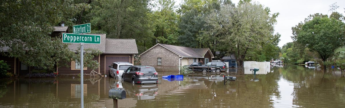
Project details are drawn from public announcements and planning materials from the City of Charleston, including the Basin Flood Action Program, the Stormwater Management project pages, and the Offices of Resilience and Sustainability, and were accurate to the best of my knowledge at the time of writing. Neighborhood associations for specific projects reflect commonly understood local geography and should be confirmed against the city’s own project maps. Public projects change in scope, budget, and timeline; verify current status before relying on any detail here. Banner photograph: City of North Charleston, CC BY-SA 2.0, via Wikimedia Commons, showing a Lowcountry neighborhood street after the October 2015 flood. This post is for general information only and does not constitute legal, financial, tax, or investment advice. Jennifer Dane is a licensed REALTOR® in South Carolina with eXp Realty LLC. Equal Housing Opportunity.